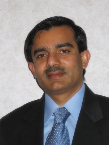
- unknown (b.)
Bio/Description
A McKnight Distinguished University Professor at the University of Minnesota, Minneapolis, Minnesota, USA, he received his B. Tech degree in Computer Science from the Indian Institute of Technology, Kanpur, India, in 1985; his M.S. degree in Business Administration and his Ph.D. degree in Computer Science in 1989, from the University of California, Berkeley, California, USA. He is internationally recognized for research, teaching and professional service in spatial databases, an interdisciplinary area at the intersection of Computer Science and Geographic Information Science (GIS). His research interests include spatial data mining and neural networks, geographic and information systems, and intelligent transportation systems, data and knowledge engineering, with a focus on storage, management and analysis of scientific and geographic data, information and knowledge. He has made major contributions to data engineering and database systems including the Connectivity-Clustered Access Method (CCAM), a new storage and access method for spatial networks, which outperform traditional indexes (R-tree family) in carrying out network computations. Other contributions relate to semantic query optimization and high performance geographic databases. In addition, he has made important contributions including the notion of co-location patterns in spatial datasets, characterization of the computational structure of spatial outlier detection, faster algorithms for estimating parameters for the spatial auto-regression model, as well one of the most scalable parallel formulation of the back-propagation learning algorithms for neural networks. One major goal of his research is to understand the computational structure of very large spatial computations (e.g. data analysis via spatial querying and spatial data mining) needed by social and physical sciences as well as engineering disciplines. Earlier in his career, his research developed core technologies in vehicle navigation devices as well as web-based routing services, which revolutionized outdoor navigation in urban environment in the last decade. His research results are now playing a critical role in evacuation route planning for homeland security and were recognized by the Center for Transportation Studies (CTS) Partnership Award (2006) for significant impact on transportation. He is a co-author of a textbook on Spatial Databases (Prentice Hall, 2003, isbn 0-13-017480-7). He co-edited an Encyclopedia of GIS (Springer, 2008, isbn 978-0-387-30858-6) and has published over 260 research papers in peer-reviewed journals, books, and conferences, and workshops. He is serving as a co-Editor-in-Chief for Geo-Informatica: An International Journal on Advances in Computer Sc. for GIS. He is a series Editor for the Springer Briefs in GIS. He was a general co-Chair for the 2011 International Symposium on Spatial and Temporal Databases and a Program co-Chair for the 2012 International Conference on Geographic Information Science. He served on the editorial boards of IEEE Transactions on Knowledge and Data Engineering as well as the IEEE-CS Computer Science & Engineering Practice Board. He also served as a Program co-Chair of the 1996 ACM International Workshop on Advances in Geographic Information Systems. He served on the 2011 National Academies' Future Work-force for Geospatial Intelligence Committee. From 2004 to 2009 he served as a member of the Mapping Science Committee of the National Research Council National Academy of Sciences, as well as the 2003 to 2004 Board of Directors of University Consortium on GIS. He received the 2006 IEEE Technical Achievement Award, "For technical achievements in spatial databases, spatial data mining, and geographic information systems". He is a Fellow of the IEEE Computer Society, a Fellow of the American Association for Advancement to Science, as well as a member of the ACM. To reach GIScience students beyond the Minnesota campus, he co-developed and co-taught a massive open online course (MOOC), titled ?From GPS and Google Maps to Spatial Computing? on Coursera. It attracted over 21,800 students from 182 countries. He?s leveraged numerous service assignments and hundreds of speaking engagements to spread the word about GIScience. In May of 2015 he received The University Consortium for Geographic Information Science (UCGIS) award, ?for his expansion and strengthening of Geographic Information Science education?.
-
Noted For:
Major contributor to data engineering and database systems including the Connectivity-Clustered Access Method (CCAM), a new storage and access method for spatial networks -
Category of Achievement:
-
More Info:


